Reinebringen, Step by Step

Amara
| 11-11-2026
 · Travel team
Hi, and welcome. You have probably seen the photo a hundred times, the one where the village of Reine sits below you in a tight cluster of red cabins and dark water.
What that photo never shows is the climb. Reinebringen is not a gentle walk up a grassy shoulder anymore, it's a staircase, and a serious one.
Reinebringen
The stairs changed everything
The old trail was a mud chute. Hikers scrambled up loose soil, and the erosion got so bad that local crews rebuilt the route with stone steps modeled on the stairways of Nepal and Bhutan. The finished path runs roughly 1,978 steps up the mountainside. It's steep from the first meter, with a grade that climbs about 450 meters over a short distance. You'll be breathing hard within ten minutes, and that's normal.
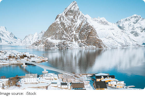
Where the route starts
The trailhead sits just off the E10 road near Ramsvik, a short drive from Reine itself. Parking is limited, maybe a few dozen spaces in the pullout, and it fills fast on clear summer mornings. Get there before 8am or you'll be circling. The bus between Reine and Å stops nearby too, which saves you the parking fight entirely.
The weather decides your view
Lofoten weather flips quickly. A blue sky at the trailhead can turn into fog at the summit in under an hour, and the view you came for disappears. Check the forecast the morning you go, not the night before. Wind is the bigger issue near the top, where the stairs are exposed and the handrail gaps widen. Bring a shell jacket even in July, because the temperature drops noticeably as you climb.
What it costs and how long it takes
The hike itself is free, no ticket, no gate. Budget around 1.5 to 2 hours round trip if you're reasonably fit, longer if you stop often for photos, which you will. The descent is harder on your knees than the climb, so poles help. Give yourself a full morning rather than squeezing it in before a ferry.
Practical things worth knowing
Wear shoes with real grip, not sneakers with worn soles, since the stone steps get slick when wet. There are no toilets or bins at the trailhead, so plan accordingly. The best light for photos hits late evening in summer, when the sun stays low and the village below glows, but that also means climbing down in fading light. Bring a headlamp if you go that route.
Who this climb suits
If you can handle a sustained stair climb and don't mind crowds at the top, you'll be fine. It's not a technical scramble anymore, no ropes needed. But it's also not a casual stroll, and people with knee trouble or a fear of exposed heights should think twice before committing.
Getting There
Most travelers fly into Leknes Airport (LKN) or Harstad/Narvik Airport (EVE), then rent a car for the drive to Ramberg. Return flights from Oslo to Leknes typically cost NOK 1,500–3,000 depending on the season. A winter rental car with proper tires starts around NOK 700–1,400 per day. From Leknes, the drive to Ramberg takes about 30 minutes on the E10. A local bus also runs along the E10, with tickets around NOK 50–100, but evening service is limited.
Where to Stay
Ramberg and Flakstad have a range of accommodation options. The Ramberg Gjestegård offers rooms from around NOK 1,200–1,800 per night, including breakfast. For a more budget-friendly option, the Lofoten Beach Camp near Skagsanden has cabins from roughly NOK 1,500–2,500 per night. In Flakstad, the Fredvang Apartments start at around NOK 1,000–1,500 per night for self-catering units. Book well in advance during the winter aurora season, as rooms fill up quickly.
Where to Eat
Dining options in Ramberg are limited but practical. The Ramberg Gjestegård restaurant serves Norwegian dishes with main courses around NOK 250–350. For a quicker meal, the local shop and café in Ramberg offer sandwiches and snacks for roughly NOK 100–150. In Leknes (about 30 minutes away), there is a wider selection of supermarkets and restaurants with main dishes around NOK 200–300. For self-catering, stock up on groceries in Leknes before heading to Ramberg.
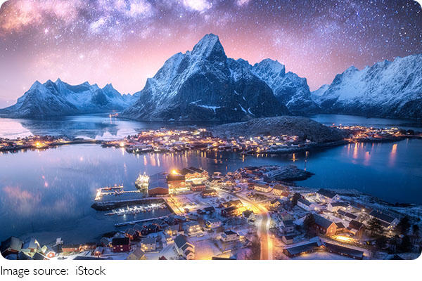
The view from the top earns its reputation, and the stairs make it reachable for far more people than the old mud path ever did. Just check that forecast, start early, and give your legs the time they need. The photo will still be there when you catch your breath.